1772
Just before the First Partition of the RTC (proposal)

B. = Bavaria, D.-N. = Denmark-Norway, It. = Italy, Mk. = Mecklenburg, P.S. = Papal States, Sx. = Saxony
1815
After the Congress of Vienna (proposal)

H.R.E. = Holy Roman Empire
1914
Before the outbreak of the First Great War

Hcg. = Dalmatian Hercegovina
Mn. = Montenegro
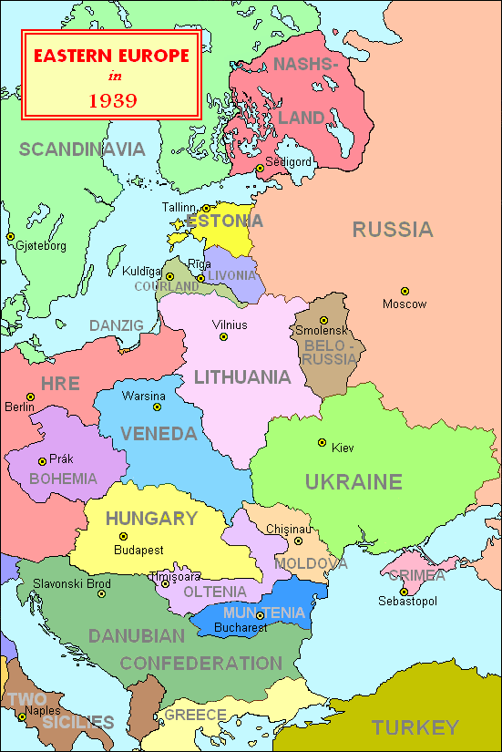
1939
Before the outbreak of the Second Great War
Apart from a few details, this has been the situation during the years 1918-1939.
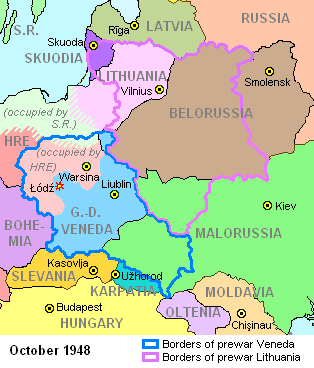
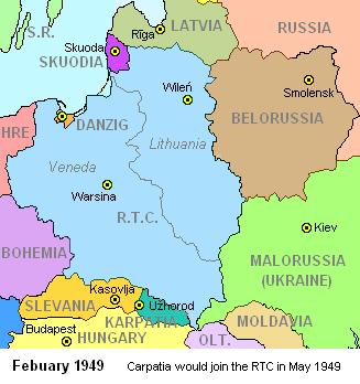
1949
After the Second Great War. This situation has remained stable until 1989, when the snorist bloc fell apart.

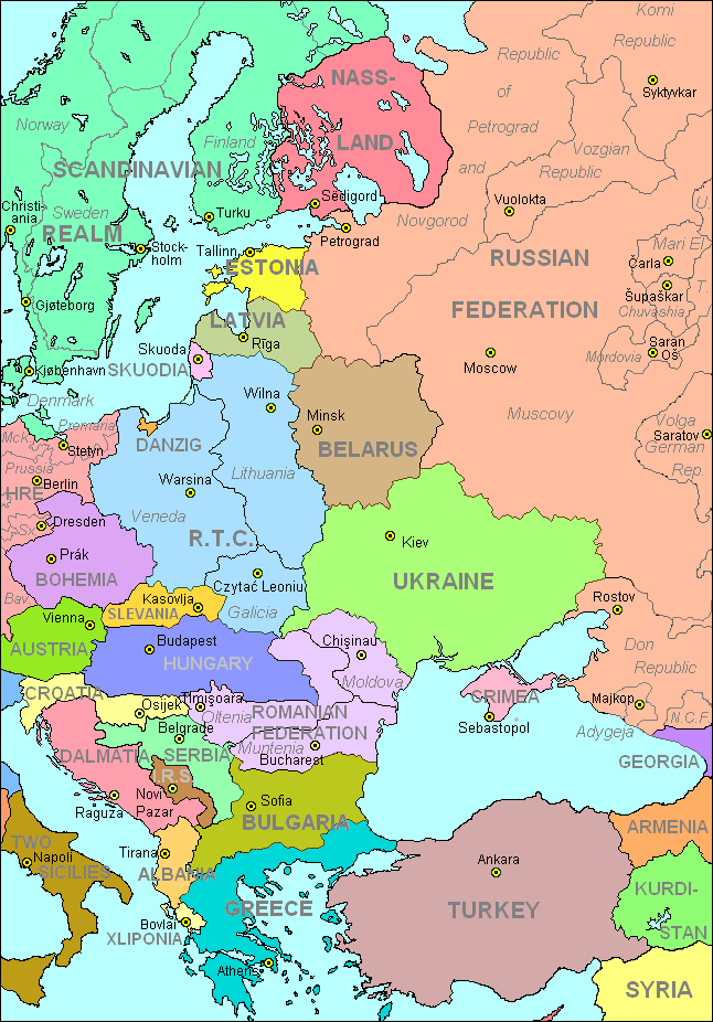
2003
The situation as it exists nowadays.
A few historical maps of the RTC